All photos from Washburn & Ronne’s “Buffalo & Niagara Frontier From The Air” 1924, Courtesy of WM. H. Loos
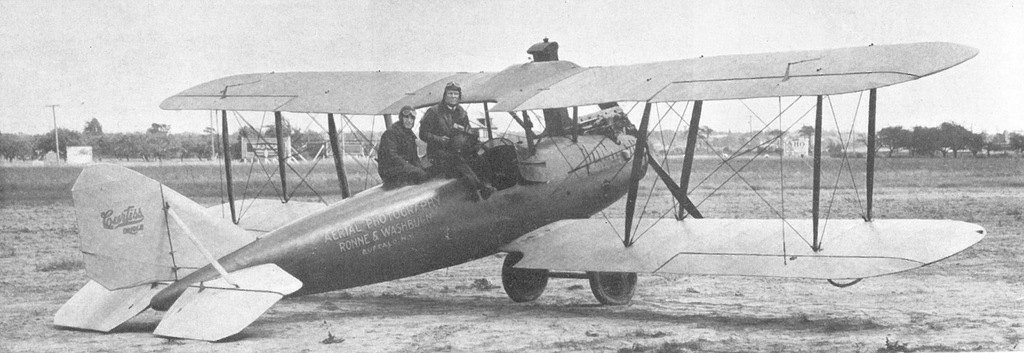
Edwin Ronne, left, and Milton Washburn, aerial photographers, and their Curtiss Bi-plane.
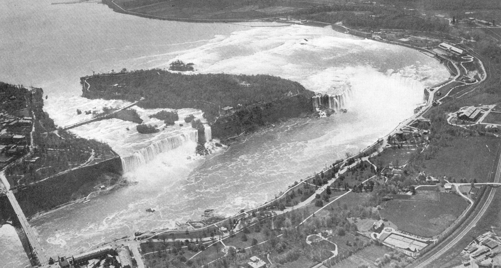
Niagara Falls. Note the park-like setting on the Canadian side, in contrast to today’s casino-driven commercialism.
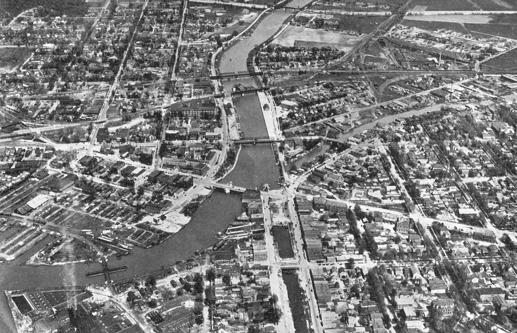
The Erie Barge Canal winds between the cities of North Tonawanda, left, and Tonawanda, right. In the middle foreground, the old Erie Canal is being filled in. Ellicott Creek goes off to the right.
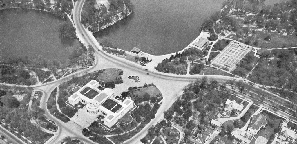
The original, formal symmetrical Albright Art Gallery facing Lincoln Parkway and Delaware Park Lake. The rose garden is fully developed adjacent to the park casino.
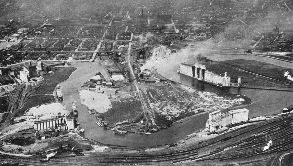
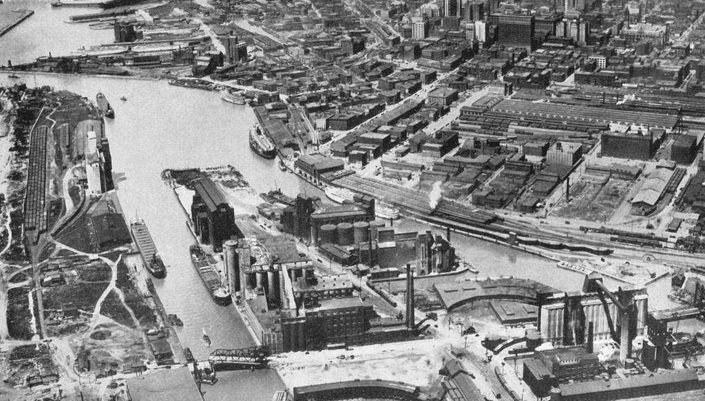
The serpentine Buffalo River creates a peninsula in the center of this view. At the right is the Concrete-Central grain elevator with three dark marine towers in the center of the elevation. At the left, the site of the Lake & Rail is vacant.
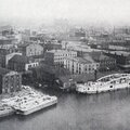
The Buffalo waterfront at the foot of Main Street. The buildings of the canal district, lower Main Street and the “Cobblestone District” are still in place. The Dakota Elevator stands near the end of the City Ship Canal. The south Michigan Street lift bridge is visible in the foreground.
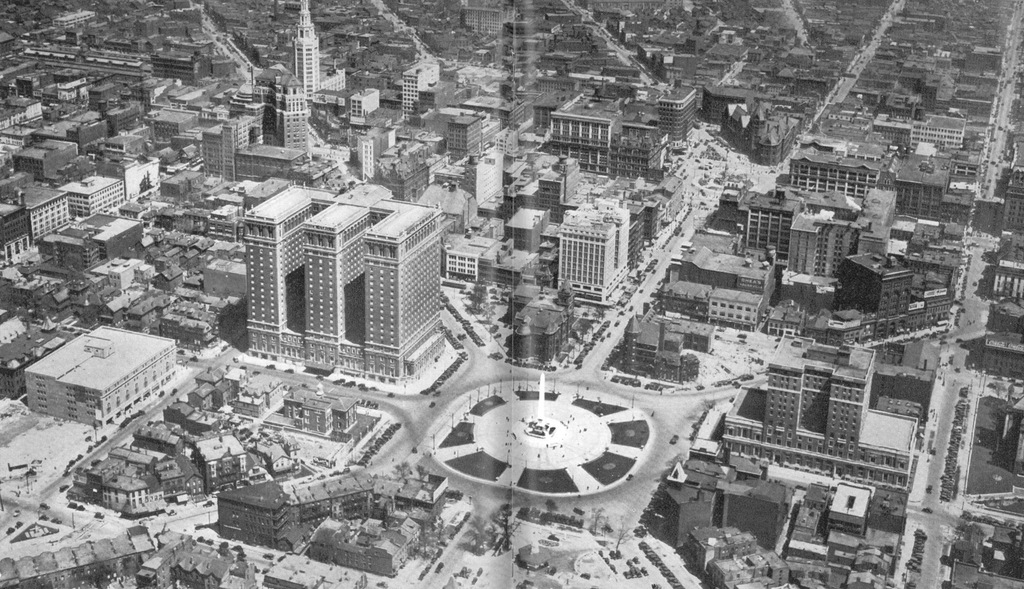
The Joseph Ellicott Radial Plan. The Statler Hotel and Buffalo Athletic Club building flank Niagara Square. The site of City Hall and the site of the new Federal Court House are filled with old buildings.